How Geospatial Data is Transforming Education in Remote Maldivian Islands
GPE KIX brings together policy makers and education planners from country partners in a course in geospatial data analysis. In the Maldives, this course enabled participants to identify gaps in education access—especially on remote islands. Read how this data-driven approach informed new education policy and expanded opportunities for students across the country. This blogpost was previously published on the GPE website here. Watch this video on the Maldives Policy Uptake, which highlights how the knowledge product produced by a team of national experts from the Maldives in the KIX EMAP Learning Cycle 2: Equitable Access to Education with Geospatial Data contributed to a much needed policy change.
“I was part of the very first A-level class at V. Keyodhoo School and fortunate to be able to continue my education while staying on my home island,” says Haanee Ahmed.
The Maldives consist of 1,196 islands grouped into 26 atolls (strings of coral islands surrounding a lagoon), a geography that poses serious challenges for delivering education to all children of the Maldives.
Until recently, students like Haanee had to move to an island offering higher secondary education to complete their final two years of school (key stage 5 – grades 11 and 12, or A-levels). “Migrating to Malé comes with lots of challenges,” she says. “When our island school started offering A-levels, I was able to avoid them.”
Hussain Simah is grateful he could stay on Keyodhoo Island, his home island, for A-levels. “I would have had to move to another island, and be away from my family and friends,” says Hussain. “It would have been very hard for me. Having my parents with me while I continue my studies has eased a lot of my mental burden.”
Previously, schools needed a minimum of 10 students enrolled to start higher secondary grades. This policy led to significant disparities in access to higher secondary education across the atolls.
On many smaller islands, students had no local option, forcing them to uproot their lives or give up on further education. The move often came with emotional strain—for both students and their parents—as well as high costs for families.
Now, thanks to the smart use of geospatial data, more students can access higher secondary education closer to home.
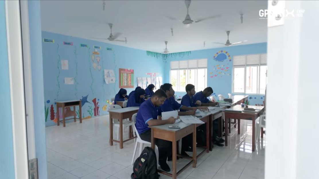
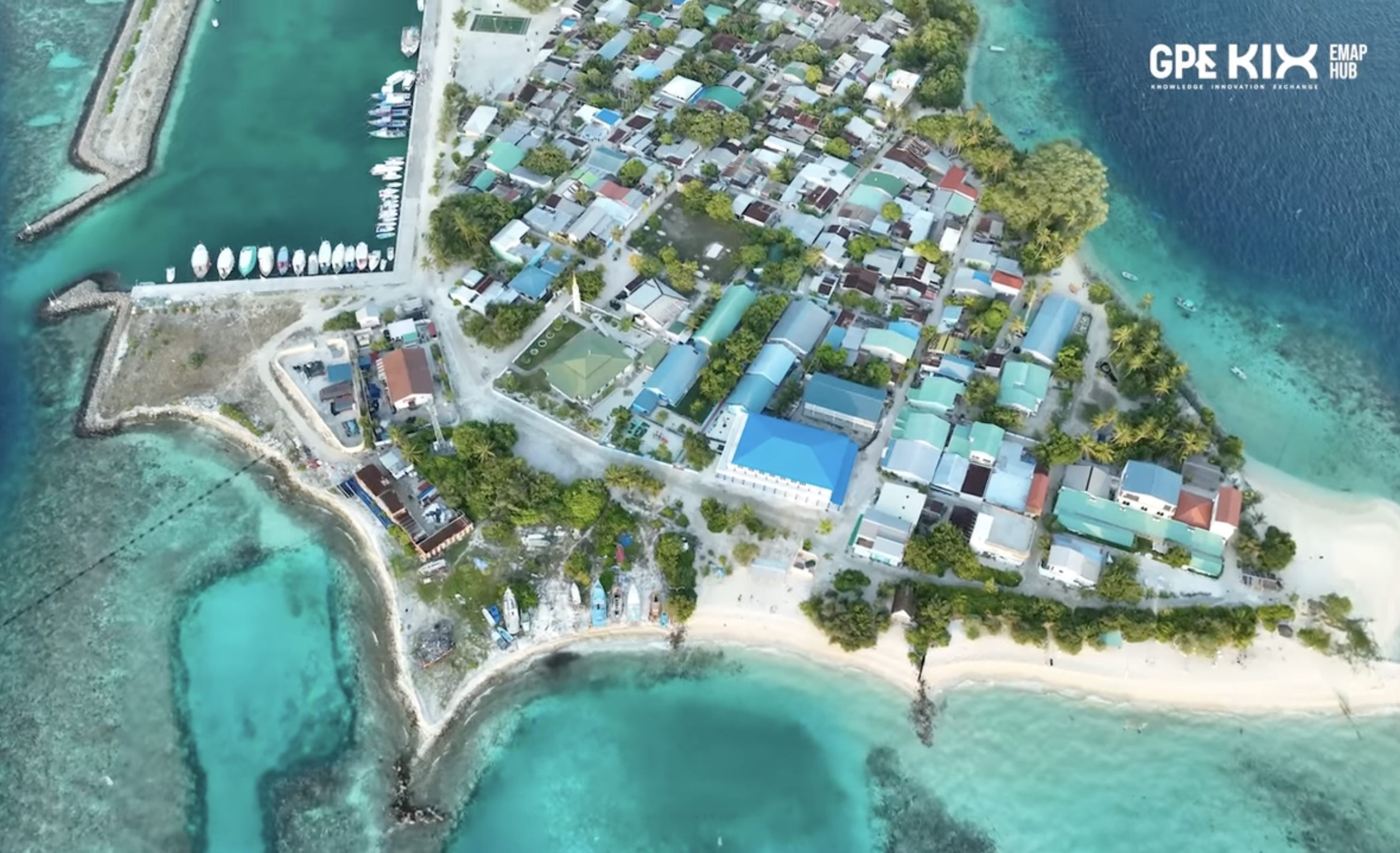
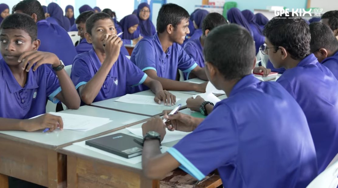
Students studying A-levels at V. Keyodhoo School in the Maldives. Credit: GPE KIX EMAP
The Potential of Geospatial Data
In 2021, Maldivian education planners and policy makers participated in a five-week course on using geospatial data to support equitable education access.
Offered through the GPE KIX EMAP Hub and delivered in partnership with UNESCO International Institute for Educational Planning (IIEP), the course—called Learning Cycles—is part of GPE KIX’s broader support for building capacity among education experts in partner countries in the Europe, Middle East and North Africa, Asia and Pacific (EMAP) region.
The Maldives was one of 10 national teams to take part in the course, which enabled participants to apply basic mapping techniques using geographic information systems, understand the role of geospatial data in education planning and management, and consider its application in promoting more equitable access to education.
For the GPE KIX EMAP Hub, it is important that the Learning Cycles include a wide range of stakeholders—from academia to government to civil society.
The team from the Maldives reflected this diversity, bringing together officials from the Ministry of Education’s planning department and academics from the Maldives National University.
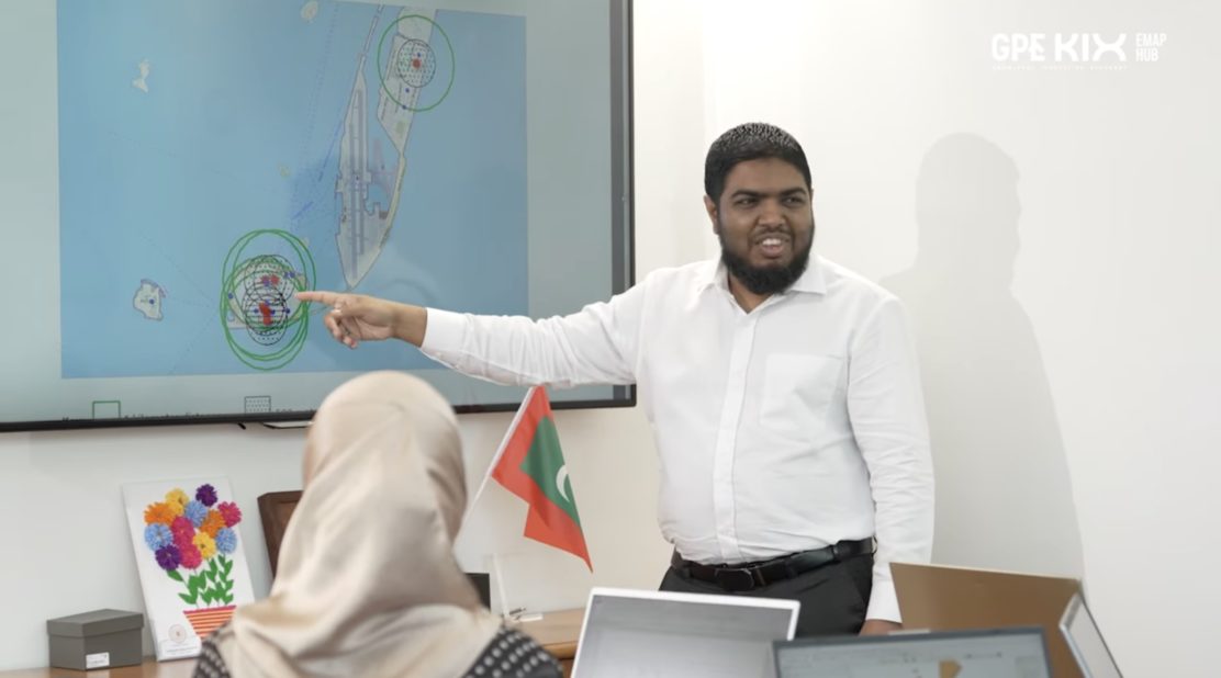
Educational planners in the Maldives using geospatial data software to improve access to education across the islands. Credit: GPE KIX EMAP
GPE’s Support to the Maldives
This work by the GPE KIX EMAP Hub aligns with GPE’s broader support to the Maldives, which prioritizes equity and inclusion, with data and evidence considered high priority.
GPE supports the country through several grants. The system transformation and system capacity grants implemented by UNICEF, focus on ensuring a more reliable data management system to identify learners’ needs, monitor progress and evaluate impact.
The Multiplier grant, implemented by the World Bank, provides additional financing to enhance evidence-based decision making through building capacity of education staff and establishing a robust EMIS.
These grants run until 2028 and will also support the creation of a dedicated training facility to improve the Ministry of Education’s capacity to collect and integrate date currently scattered across multiple systems, enabling a more comprehensive view of educational outcomes.
Beyond GPE, other complementary efforts are being implemented that are strengthening the overall data ecosystems for decision making and improved education outcomes. For example, Google and UNICEF supports the expansion of upper secondary grades.
Students studying A-levels at V. Keyodhoo school in the Maldives. Credit: GPE KIX EMAP
How Attendees (and ultimately children) Benefited
Using geospatial software, education planners mapped population densities, school locations, catchment areas, transport infrastructure and other crucial factors for the higher secondary grades.
Overlaying this information allowed them to identify underserved areas and prioritize them for new school construction.
“By analyzing geospatial data, planners can allocate resources more efficiently and prioritize areas with the highest needs. Limited resources can then have maximum impact—allowing planners to strategically place new schools where they are more easily accessible to vulnerable children, such as those in remote areas or poorer neighborhoods.” – Am Gagnon, A course instructor
“Before the training, we didn’t have a systematic way of identifying the issues in terms of access to education in the Maldives. Now we can take a more technical and systematic approach to identify gaps, particularly in higher secondary education.” – Moosa Adam, An educational planner at the Ministry of Education who attended the course
These insights directly shaped policy decisions.
“The Ministry of Education realized the gap in access to higher secondary education in the outer atolls, especially in Alif Dhaal and Vaavu. So a policy decision was made to increase accessibility by allowing students to study in their home atolls.” – Ibrahim Asif Rasheedh, Ministry of Education official
As a result, at least one island in each atoll will be allowed to start higher secondary education even though the school has less than 10 candidates wanting to study A-levels.
Geospatial Data Changes Lives
GPE KIX works globally to ensure the most innovative, evidence-based practices are used by decisions makers shaping education policies. In the Maldives, the GPE KIX EMAP Hub successfully facilitated this kind of evidence uptake.
The GPE KIX EMAP Learning Cycle in geospatial data is a clear example of this approach. “This Learning Cycle shows how data can resolve complex and recurring issues,” adds Steiner-Khamsi. “It will have a huge impact—not just for students and their futures, but for teachers and parents too.”
With technology as their ally, education planners and policy makers are transforming the educational landscape in the Maldives, one school at a time.
Haanee is just one of many students already seeing the benefits. “I have just been selected for a job at the Island Council,” she says. “I earned this opportunity thanks to my A-levels.”
KIX EMAP Outcomes in Action: Maldives Policy Uptake
“We are living in a time with no shortage of data, evidence or scoping studies, but there’s not much uptake of all this material. We believe it makes a real difference when national policy experts and analysts are part of the data production process. This will drastically improve its use in education.” – Gita Steiner-Khamsi, Lead Researcher at the GPE KIX EMAP Hub
“This KIX EMAP Learning Cycle focused on geospatial data to improve education access—a priority identified by KIX national teams. With this in mind, for this Learning Cycle, we partnered with UNESCO International Institute for Educational Planning.” – José Luis Canêlhas, KIX EMAP Hub Director
“The Maldives example shows what we aim for with KIX EMAP Hub Learning Cycles: knowledge and policy recommendations developed by a national team being taken up in a new education policy or practice.” – Marina Dreux Frotté, KIX EMAP Hub Education Policy, Evaluation and Learning Lead
“The Learning Cycle report highlighted lack of access to higher secondary education in some regions of the country. Its findings and recommendations led to policy change and policy update.” – Visal Moosa, KIX EMAP National Coordinator for the Maldives
“I would have had to move to another island, and be away from my family and friends. It would have been very hard for me. Having my parents with me while I continue my studies has eased a lot of my mental burden.” – Hussain Simah, A-level student
“The school has benefited in many ways since the commencement of A-levels. Now, [A1] these students mentor students in grades 9 and 10, helping them improve their performance. Additionally, it encourages students to pursue a career in education.” – Zaeema Hussain, V. Keyodhoo School Principal
“By using geospatial data in the Learning Cycle, we’ve identified major gaps in access to higher secondary education. These findings have helped our policy makers take informed decisions across different regions of the Maldives.” – Dr. Aminath Shafiya Adam, Educational planner
“I am very pleased that the school now offers A-levels. We would bear huge expenses if we had to send our kids to Malé. Studying while staying with your parents at home brings happiness to everyone.” – Jazeela Mohamed, Parent
“Previously, many students who completed their lower secondary education exited the formal education system due to the lack of A-level opportunities on the island. Now, students are retained in the education system for an additional two years. This helps to keep them away from negative influences.” – Ahmed Siraj, President of V. Keyodhoo Island Council
The Authors
Visal Moosa, Islamic University of Maldives
Rasha Sharaf, GPE KIX Europe, Middle East, North Africa, Asia, and Pacific Hub